It's been at least 17 years since the last time I rode the trails east of Mt. Hood. I connected Surveyor's Ridge to Knebal and 8 Mile, finishing it off with a romp down Dog River. This is Oregon XC mountain biking at its finest, with incredible views, flowing single track, all within an hour and a half outside of Portland, OR.
Solstice
Normally, one would either session Dog River via shuttle runs, ride Surveyor's Ridge as an out and back, or even loop 8-Mile and Knebal as separate rides. Not for this endurance junkie. On the longest day of the year I strung together one glorious loop, covering 50 miles and climbing over 8,000'.
The Route
I started at the Hood River Valley Ranger Station, and made my way up towards the northern end of Surveyor's Ridge. I was following another rider's GPS data, which didn't sync properly to my Garmin. Luckily I had it saved as a route I created on Strava and eventually found my way to the trailhead by way of steep ATV trails.
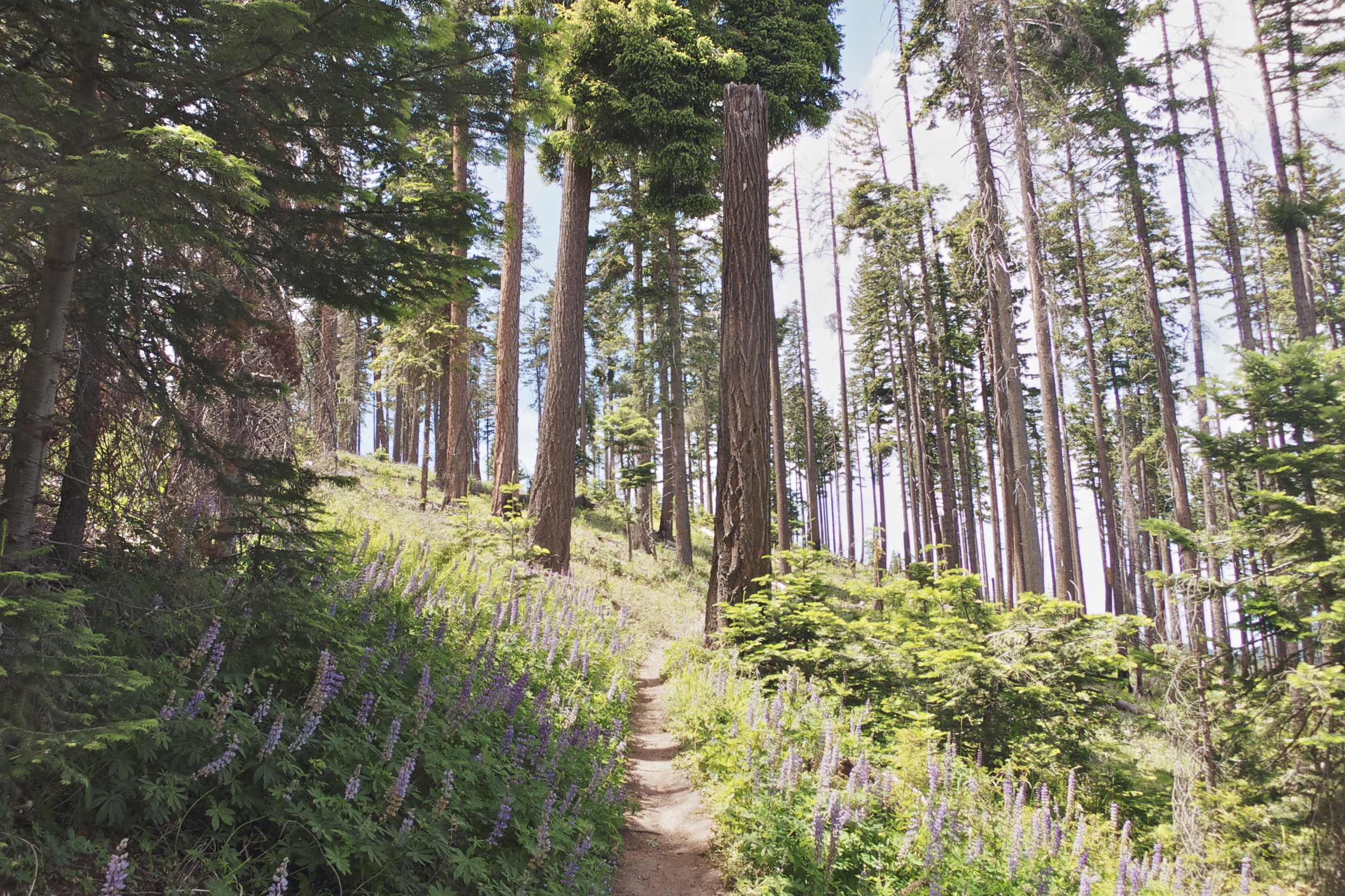
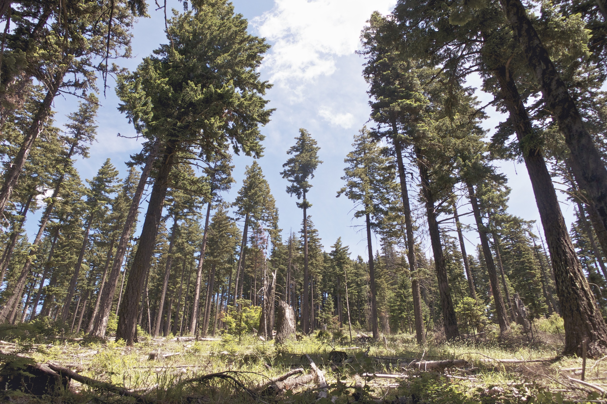
Surveyor's Ridge
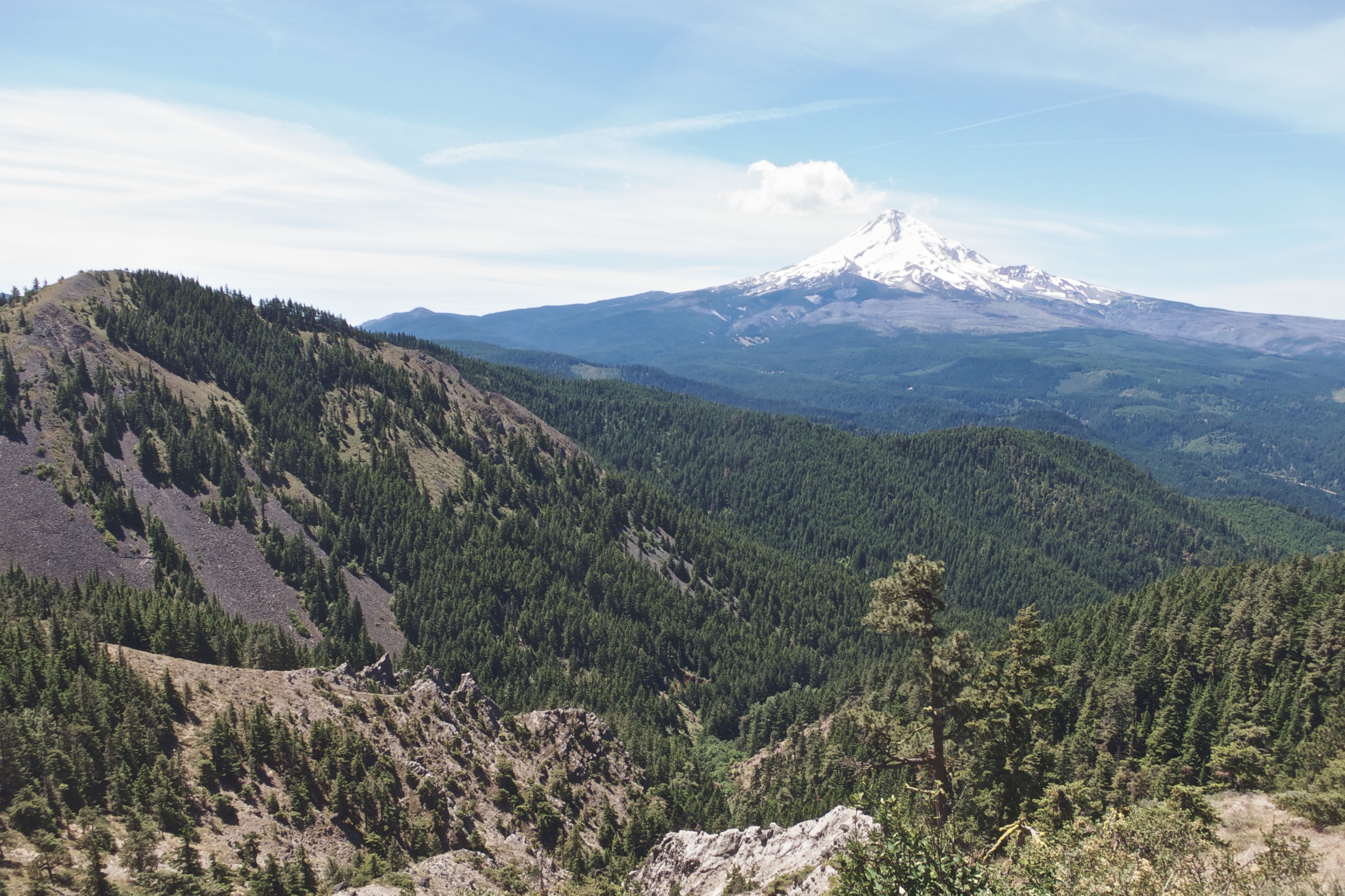
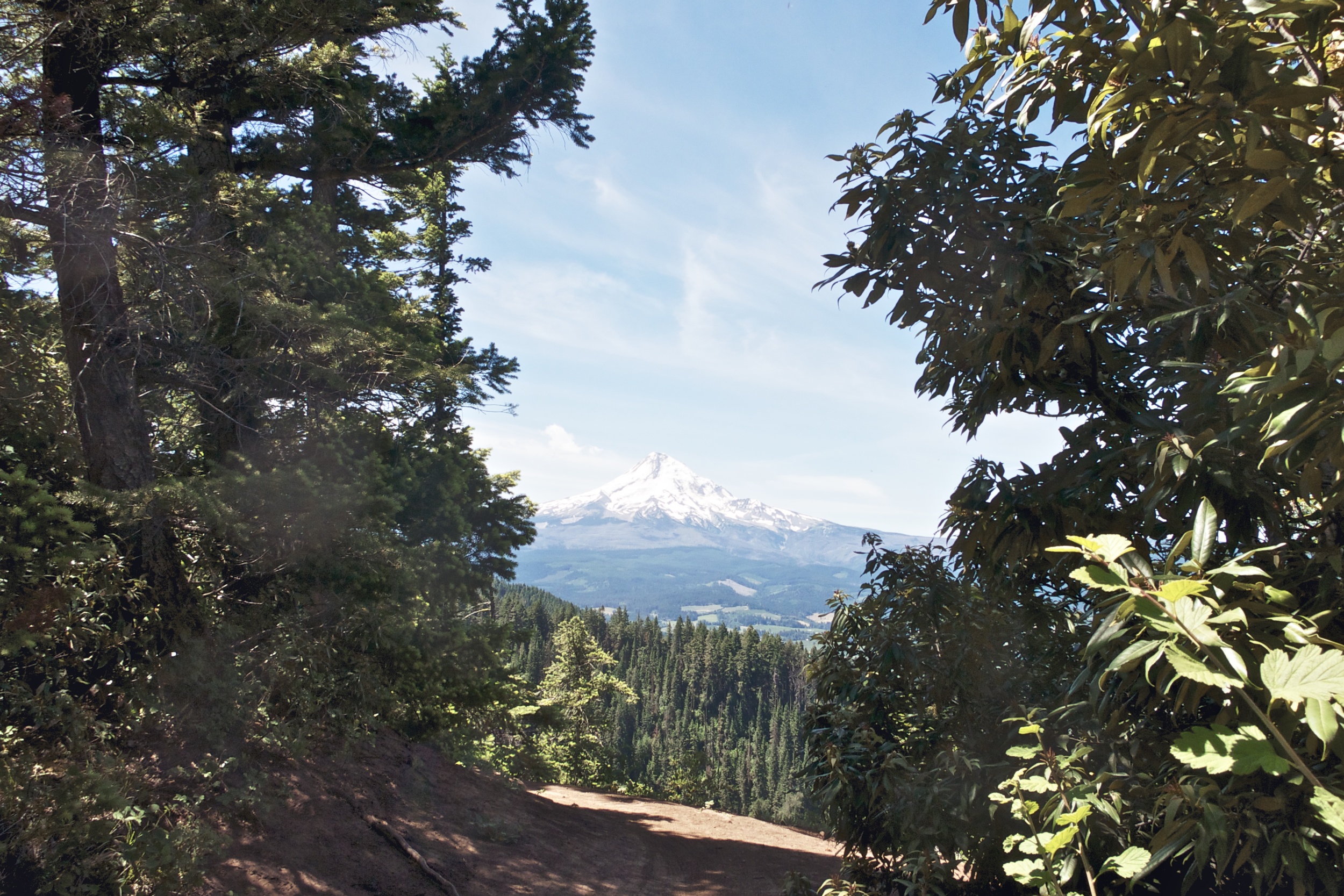
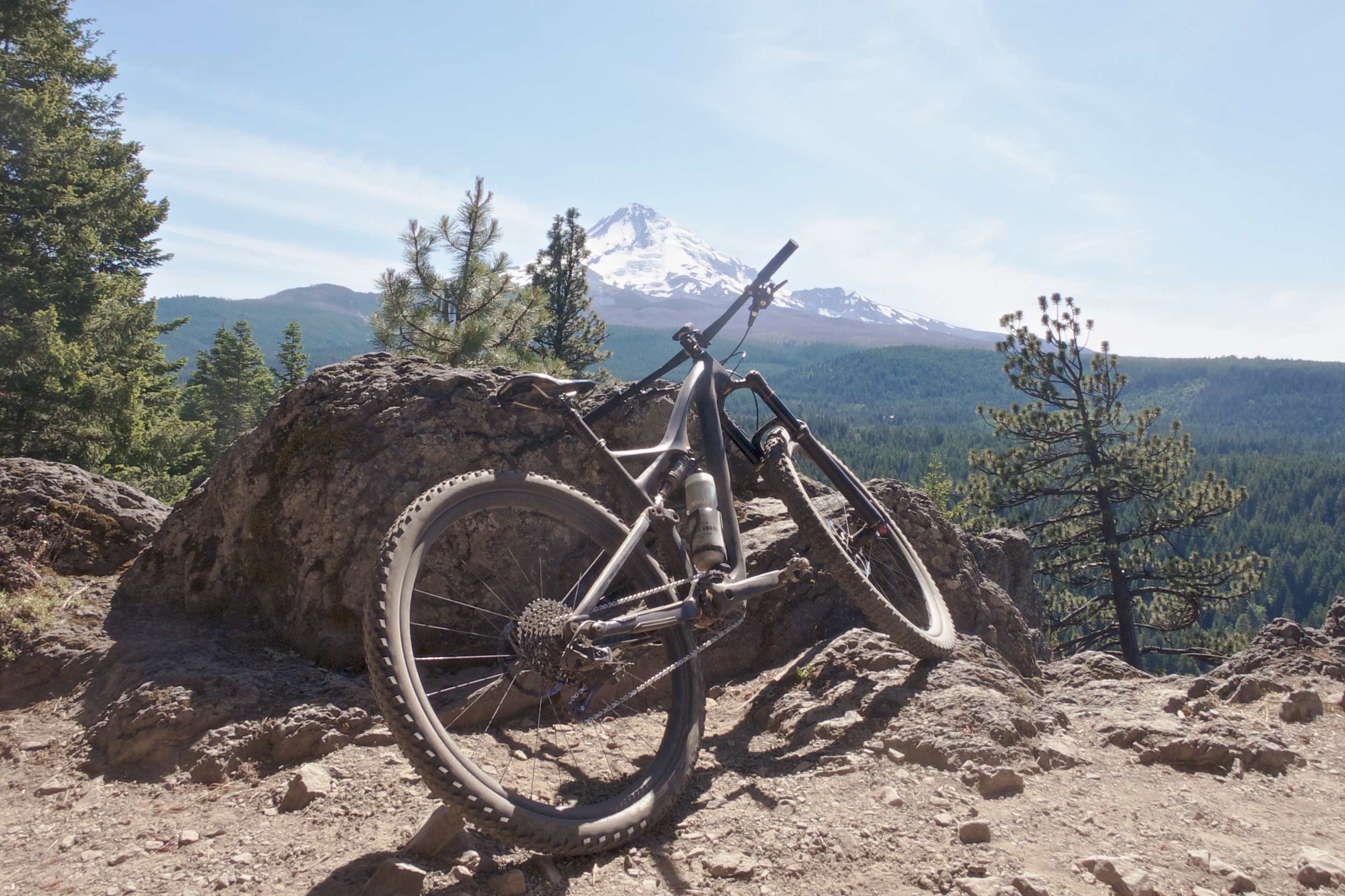
The single track slowly starts out with a gentle climb through lush forest and scattered rock. It's not too technical at this point, but I'd class this trail as intermediate. The views begin to open up as Mt. Hood looms out in the distance. You're actually pretty high as you continue to gain in elevation before it starts rolling down.
On the few occasions it does tilt otherwise it's met with a ton of fun, fast with inescapable jaw-dropping views of mountain ridges to your side as you pick your line through powdery and flowing dirt. This section alone is what gives Surveyor's Ridge its personality and charm. You really have to work your ass off to get to this point.
Knebal
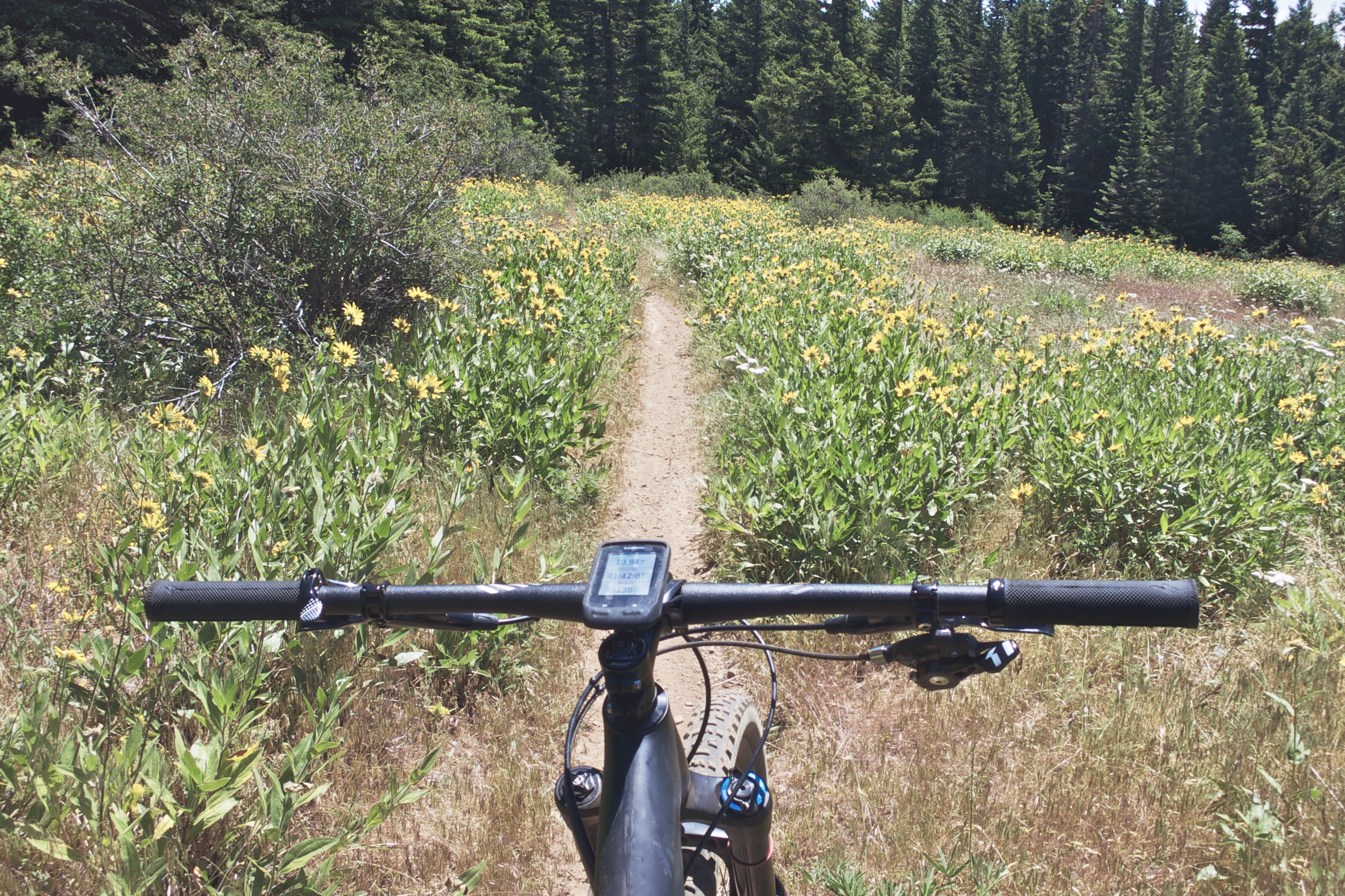
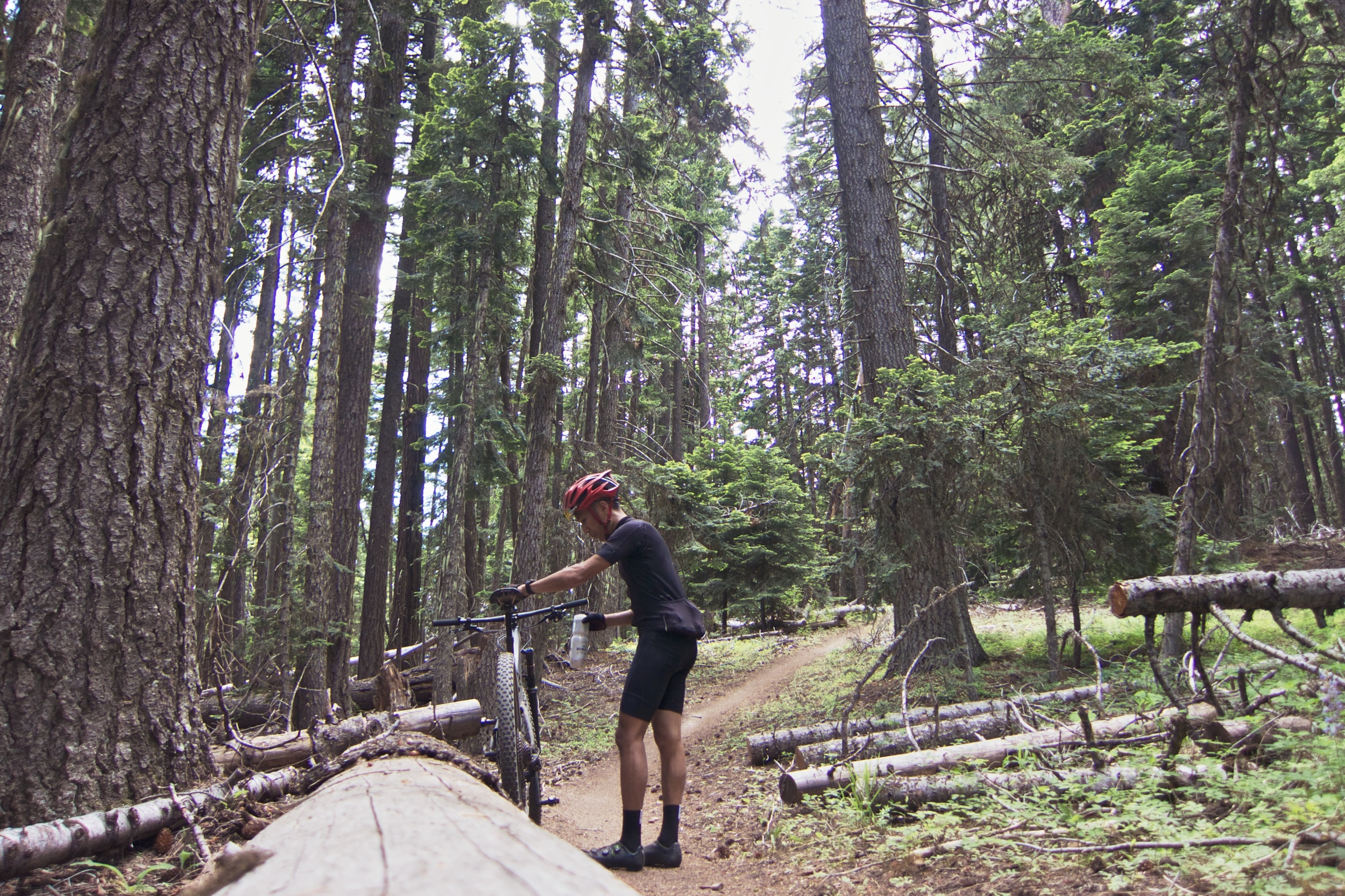
There's a new connector from Surveyor's Ridge over to Knebal, freshly cut and twisty alongside a fire road, where the trees begin to open up and the dust gets deeper. It's a novel thing to build a berm on loose dirt, feeling slow and incapable, granted it'll take some time for it to compact down for its intended use, but deeper into the Knebal trail network you understand where they're coming from.
Fast and flowing, Knebal somehow squeezes in a lot of trail perfection in such a short series of segments. Nothing ever feels too steep or physical. The right balance of brush, blooming flowers and pine trees set up the most picturesque backdrop I've ever ridden. There's a parking lot just at the bottom of the trail, as well as a fresh water stream if you're brave enough to drink. I had no choice in the matter and refilled my single bottle.
Fortunately the top leads to even more blissed-out trail nirvana as you connect to the backside of Knebal and onto warp speed single track.
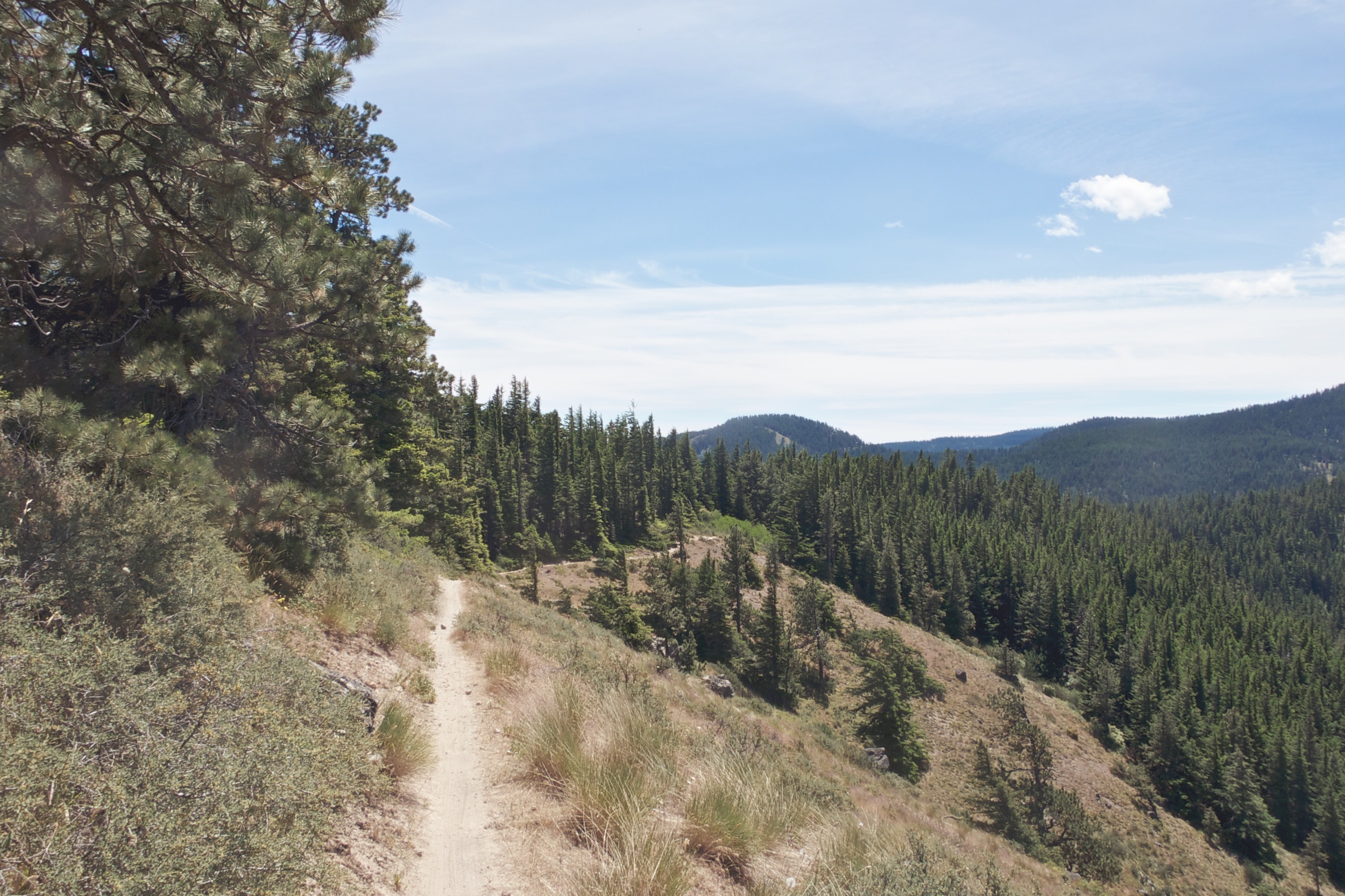
8 Mile
Talk about flow, 8 Mile is legit. I'm not talking about big swooping turns, but a fast and playful section of natural mini table top and double features. It felt like I could jump off anything without fear of getting in over my head, and just carve this trail days. You're surrounded by towering pine trees, so the extra coverage is probably what keeps the trail intact and it's respective riders cool in the summer heat.
The moment has finally come when you realize you're at the bottom and have to climb your way out. Fortunately the top leads to even more blissed-out trail nirvana as you connect to the backside of Knebal and onto warp speed single track. Carving in and out of trees, dusting turns and floating over roots, made possible by my capable trail bike and curiosity to see how much more fun can I have in a single day.
All I could recall was the eight glorious miles of non-stop, heart pounding descending, over big rocks, roots and rutted out corners.
Dog River
I'm about four and half hours into my epic ride, and just reached the top of Knebal once more, knowing I've come to the Dog River portion of the route. The last time I rode there was at least 17 years or so ago. All I could recall was the eight glorious miles of non-stop, heart pounding descending, over big rocks, roots and rutted out corners. A technical descender's dream. The trails remind me a lot of the Santa Cruz mountains, Demo in particular.
Fast forward some years ahead, I'm still giddy as high schooler, but aboard a beast of a bike with more trail experience and confidence under my belt. I attacked early on and found myself overshooting and nearly crashing into a few unsuspecting tree stumps and ledges. Simmer down. It's as fun as ever and more challenging than I remembered. This completes the epic loop as your slow roll your way back to the ranger station just a few miles north.
Ride Data
STRAVA
http://www.strava.com/activities/329587123
Distance: 49.3mi
Moving time: 4:58:40
Elevation: 8,110ft